Chesapeake Bay runs due south from Baltimore until it opens out into the Atlantic Ocean just north of Virginia Beach. Delaware and Maryland occupy most of the long Delmarva Peninsula to the east of Chesapeake Bay, but the southern tip is part of Virginia. The wide bay separating the Eastern Shore from the rest of Virginia used to be a major geographical divide as a result of which the the area has a unique history of settlement and development. There were no minerals to attract prospectors and its isolation limited the development of industry, so those who settled in the Eastern Shore remained primarily dependent upon the land and the sea. Even though it is now linked to the rest of Virginia this remains a relatively quiet part of the state.
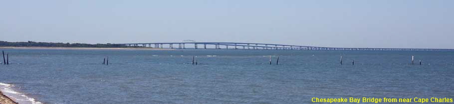
Chesapeake Bay Bridge-Tunnel from near Cape Charles
The isolation of the Eastern Shore began to end in the early 1930s with the introduction of vehicle ferry services. The ferries were prone to disruption in bad weather, so in the 1950s a fixed link was proposed. The 37 kilometre (23 mile) long Chesapeake Bay Bridge-Tunnel opened in 1964 connecting the tip of the peninsula to Virginia Beach. There are two tunnels, each 1.6 kilometres (1 mile) long to allow large naval vessels to pass. This picture shows the bridge leaving the southern tip of the Delmarva Peninsula.
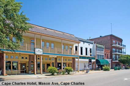
Cape Charles Hotel, Cape Charles
Cape Charles was founded in 1884 when it was built as a railroad and ferry town. It was a busy railroad terminus and port, the nearest thing to a boom town that could be found on the Eastern Shore. The ferry services ceased in the 1950s but railway barges carrying rail cars across the bay continued to use the port. The end of the ferry service sent the town into decline. Cape Charles Hotel was built in 1884 and its fortunes followed those of the town. In 2002 its fortunes changed when new owners renovated the hotel bringing it up to date while preserving its character. At the time of writing the hotel was closed due to the retirement of its owners and its future uncertain.
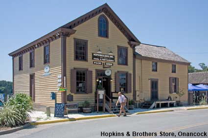
Hopkins & Brothers Store, Onancock
Originally called Port Scarborough, the town of Onancock was founded in 1680. Its name is derived from the Indian word ‘auwannaku’ meaning foggy place. The town sits at the end of Onancock Creek, a 6 kilometre (4 mile) long inlet from Chesapeake Bay. The town wharf remains active today but mainly now for pleasure craft rather than commercial traffic. Near the wharf stands the historic Hopkins and Brothers Store, which was founded in 1842 making it one of the oldest general stores on the East Coast. The store now houses Mallard’s restaurant where you can have a meal with a view down the creek.
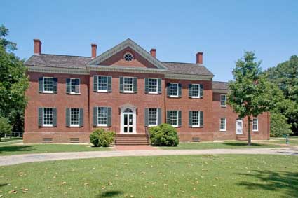
Ker Place, Onancock
John Shepherd Ker was a successful merchant, banker, lawyer and gentleman farmer. In 1793 he acquired 147 hectares (364 acres) of land on the Eastern Shore. In 1799 he began construction of a Federal-style mansion, which was complete by the time of his death in 1806. In 1960 the house with a small amount of land was acquired by the Eastern Shore of Virginia Historical Society. They authentically restored the mansion back to its 1799 roots and furnished it to suit the period. The Historical Society uses Ker Place both as their headquarters and as a museum that takes visitors back to the time of John Shepherd Ker in the thriving port of Onancock. Click Tab 2 to see the Chesapeake Bay Log Canoe salvaged from a nearby marsh that is displayed in the grounds.
Eastern Shore
Click on Minimap to navigate


DLU100711



To move forwards or backwards through the Virginia trail click the arrows above, or select your next destination on the Minimap.


© Mike Elsden 1981 - 2025
The contents of this page may not be reproduced in full or in part without permission

