In the middle of the peninsula formed by the Puget Sound in north west Washington stands Mount Olympus, the highest mountain of the Olympic Range rising to a height of 2,427 metres (7,962 feet). The mountains may be dwarfed by the volcanoes of the Cascade Range to the east, but the peninsula is home to a large area of unspoilt temperate rain forest, mountain ice fields and some wild coastal scenery. President Theodore Roosevelt made the mountain area a National Monument in 1909, primarily to protect the herds of elk. In 1938 President Franklin D Roosevelt signed the act making it a National Park and the coastal strip was added in 1953.
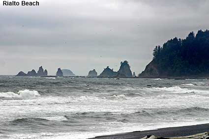
Rialto Beach
This picture from our 2006 trip is more typical of the weather that we have encountered, although shortly after this was taken some bright sky began to appear on the western horizon. Rialto Beach is a six kilometre (4 mile) stretch of the coast near the northern end of the peninsula and it is a riot of sea stacks and tide pools. Even in bad weather, the beauty of this section of wild coast shines through.
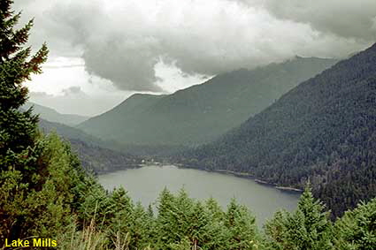
Lake Mills
In the north of the park another short drive up the Elwha Valley into the park took us to Lake Mills. This artificial lake formed behind the Glines Canyon Dam which was built in 1927 to provide hydroelectricity. Lake Mills no longer exists as in 2012 the dam was been removed in order to restore the area and river flow back to their natural state.
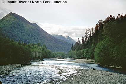
Quinault River at North Fork Junction
Most of the mountain section of the National Park is wilderness and only accessible on foot. However in a few places it is possible to drive a short distance into the park. In the south of the park you can drive from Quinault Lake just outside the park along a gravel road that takes you to campsites on the east and north forks of the Quinault River. This picture shows the dense rainforest near the fork in the river.
Olympic National Park
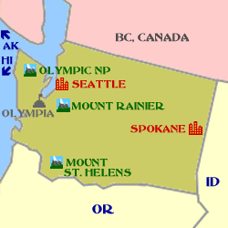
Click on Minimap to navigate
Home > US States > The West > Washington State >
DLU070212 M120427
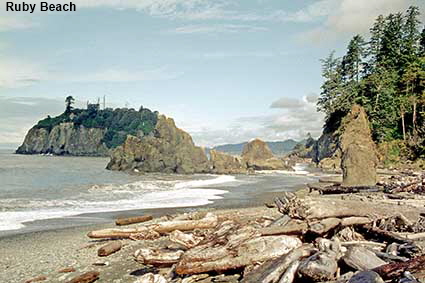
Ruby Beach
The western side of Olympic National Park is temperate rainforest and receives over 3.6 metres (12 feet) of rain each year. It is perhaps not surprising that during both of our visits to the park the weather was a little dull and damp. This picture from our 1981 visit is the only one that has a significant area of blue sky in it. Ruby Beach is one of the more accessible parts of the coast, just a short walk from the a car park off Route 101. This part of the coast is renowned for its sea stacks. The picture shows the beach strewn with logs, the result of an active logging industry in western Canada and north western USA.



To move forwards or backwards through the Washington State trail click the arrows above, or select your next destination on the Minimap.


© Mike Elsden 1981 - 2025
The contents of this page may not be reproduced in full or in part without permission

