If you fly in to Seattle-Tacoma International Airport when the weather is good you can hardly miss the huge mountain looming over Seattle and Tacoma. Mount Rainier is an active volcano only 87 kilometres (54 miles) from downtown Seattle and even closer to Tacoma. Although dormant at the moment, it is likely that one day it may rumble back into life, just like Mount St Helens did in 1980. Meantime the slumbering giant provides some wonderful scenery including temperate rain forest, wildflower meadows, glaciers and snow fields. The area was protected from logging as early as 1893 and in 1899 President William McKinley made Mount Rainier the fifth National Park in the USA.
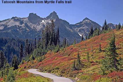
Tatoosh Mountains from Myrtle Falls trail
Although the Tatoosh Mountains provide the backdrop to the previous 1981 picture, they were much more visible when we visited in 2006. These jagged mountains adjacent to the National Park form part of a protected wilderness managed by the US Forest Service. In the foreground, an unusually warm and sunny day in late September brings out the colours of the meadows on the slopes of Mount Rainier.
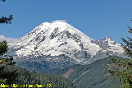
Mount Rainier from Route 12
A little halo of cloud over the summit seems fitting in view of Mount Rainier’s current dormant state. It last erupted around 150 years ago and is definitely not considered extinct, indeed it is monitored very carefully for any signs of unusual activity. Mount Rainier is the highest volcano in the Cascade Range at 4,392 metres (14,410 feet) high. This picture was taken from Route 12 to the east of the park. Mount Rainier is so large that many of the best views of it are from outside of the National Park.
Mount Rainier National Park
Click on Minimap to navigate
Home > US States > The West > Washington State >
DLU070213
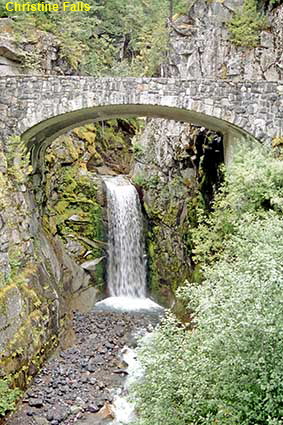
Christine Falls
Apart from having its very own volcano, the National Park has mature forests, wildflower meadows, lakes, snow fields and glaciers. Oh, and a good few waterfalls as well, many fed by glacial melt water. Christine Falls are not the highest in the Park, but framed by the arch of a road bridge they are among the most attractive.
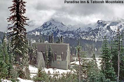
Paradise Inn & Tatoosh Mountains, Mount Rainier National Park
The day we went through the National Park in 1981 we started in a temperate coastal climate, by lunchtime we were in snow at Paradise Inn, then we spent the night in a positively hot Toppenish. Three climates in one day! Paradise Inn stands at 1,646 metres (5,400 feet) and in winter it can be very deep in snow. Most of the Inn dates from 1926 but with some remnants of a 1917 lodge that was destroyed by fire. Normally you can stay at the Inn, but when we visited in 2006 it was undergoing major renovation work.
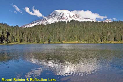
Mount Rainier & Reflection Lake
This view of the snow clad summit of Mount Rainier reflected in Reflection Lake is one of the most photographed views in the National Park. Sadly there was a light breeze when we visited which was disturbing the reflection, but the picture is still worth showing.



To move forwards or backwards through the Washington State trail click the arrows above, or select your next destination on the Minimap.


© Mike Elsden 1981 - 2025
The contents of this page may not be reproduced in full or in part without permission

