Back in 1980, people on the west coast of the USA had become perhaps a little over confident about the huge volcanoes scattered in their midst. OK, Lassen Peak in California caused a few fireworks in 1914/15, but the rest of them seemed to be pretty well extinct. On May 18, 1980 Mount St Helens woke up with a bang, giving west coasters a rude awakening about the nature of the volcanoes in the Cascades Range. 57 people died in the eruption and the height of the mountain was reduced from 2,945 metres (9,670 feet) to 2,549 metres (8,363 feet). The damage caused by the explosion was widespread and is still very visible today. Mount St. Helens National Volcanic Monument has been set up to inform visitors about the 1980 eruption and to allow them to view the area.
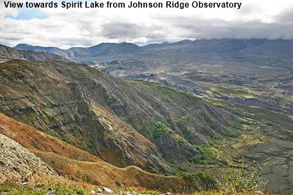
View towards Spirit Lake from Johnson Ridge Observatory
The Johnson Ridge Observatory normally provides the best view of Mount St Helens in the National Volcanic Monument. Unfortunately for us, cloud moved in while we were in transit from the Loowit Viewpoint to the Observatory, so we did not get a clear view of the summit. However, we did get a clear view of the devastated area towards Spirit Lake. This was where Harry R Truman lived and died. He had been running the Mount St. Helens Lodge there since 1928 and the threat of a major eruption was not going to make him leave. Spirit Lake and the Lodge were engulfed by the pyroclastic flow from the volcano and Truman’s body was never found.
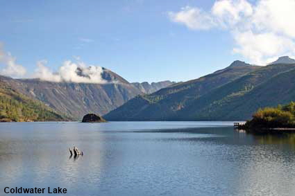
Coldwater Lake
Prior to the eruption this was plain old Coldwater Creek. A huge amount of material flowed from the volcano down the North Fork Toutle River damming the outlet of Coldwater Creek in the process. Although it was only 26 years old when this picture was taken, Coldwater Lake looks surprisingly natural with just a tree stump emerging from the surface to give a clue to its origin.
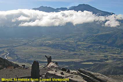
Mount St Helens from Loowit Viewpoint
Prior to the eruption, Mount St Helens had a classic volcano shape and was often compared to Mount Fuji in Japan. As well as reducing its height by 396 metres (1,307 feet), the eruption completely changed the shape of the mountain. Our first visit to Washington State was in 1981 and the scale of the destruction meant that we could not get close to Mount St Helens. When we visited in 2006 we drove the road up to Johnson Ridge Observatory and found Mount St Helens was still far from quiet. In this picture, steam can be seen rising from the crater just above the ribbon of cloud. In the foreground, trees that were felled by the explosion still lie rotting on the ground.
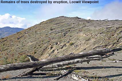
Remains of trees destroyed by eruption, Loowit Viewpoint
One sign of the 1980 eruption that will not be around for much longer is the trees felled by the blast. The massive pyroclastic flow that emanated from the volcano felled all the trees in its path for up to 27 kilometres (17 miles) from the volcano. Further from the volcano the trees were left standing but their needles were burned off. The direction of the flow can be identified from the lie of the felled trees, so in this picture Mount St Helens is off to the left. The tree trunks are now in an advanced state of decay and within a few years they will have rotted away.
Mount St. Helens
Click on Minimap to navigate
Home > US States > The West > Washington State >
DLU070214
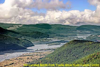
Devastated North Fork Toutle River from Forest Center
Much of the debris from Mount St Helens headed down the North Fork Toutle River for a distance of some 21 kilometres (13 miles). In places the valley floor has been raised by as much as 180 metres (600 feet). At the point where this picture was taken the old valley floor begins to emerge from the devastation including the road that used to run to Spirit Lake. A total of 300 kilometres (185 miles) of highway were destroyed by the eruption.



To move forwards or backwards through the Washington State trail click the arrows above, or select your next destination on the Minimap.


© Mike Elsden 1981 - 2025
The contents of this page may not be reproduced in full or in part without permission

