South Carolina has fertile farmland in abundance so it is not surprising that its settlers established many plantations. The main crop was cotton, apart from some parts of the coastal area where rice predominated. Large plantations required large numbers of slaves and by the time of the Declaration of Independence there were over 80,000 slaves in South Carolina. With its economy highly dependent upon slave labour, South Carolina took a strong anti-abolitionist line and when Lincoln was elected President in 1860 it was the first State to secede from the Union. In the later stages of the Civil War, many ot the plantations were destroyed by Union Soldiers under General Sherman. Fortunately a number of Plantation Houses survived and in have now been preserved in order to provide an insight into the history of South Carolina.
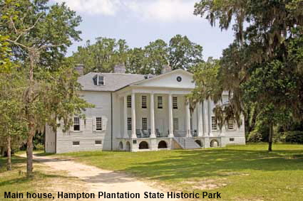
Hampton Plantation State Historic Park
Hampton Plantation dates back to 1744 when Daniel Horry purchased 240 hectares (600 acres) from Anthony Bonneau to establish a rice plantation. The central part of the plantation house was built at about that time. Further land acquisitions considerably enlarged the plantation. Horry died in 1762 and left the plantation and its slaves to his son Daniel Huger Horry. During the 1760s Daniel added a wing to each side of the house. He died in 1785 and his wife Harriott continued to live there although ownership passed to his son. She added the front portico in 1791, modelled on the one at Hampton House in England. The house was owned by descendants of Harriott right up to 1971 when it became a State Historic Site and was opened to the public. Click Tab 2 to see the Kitchen House.
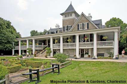
Magnolia Plantation & Gardens, Charleston
A land grant to Morris Matthews in 1672 is the first evidence of settlement here beside the Ashley River. The land was bought by Stephen Fox and in 1676 his daughter and her husband Thomas Drayton built a house with small formal garden and started cattle ranching on the land. By the time Thomas Drayton died in 1717 they had started to grow rice. Magnolia Plantation was passed to his eldest son, while another son set up Drayton Hall on land adjacent to it. The house was burned in 1865 during the Civil War probably by freed slaves. After the war the house was replaced with an antebellum house from Summerville and in the early 1870s the the gardens were opened to the public. Magnolia Plantation is still owned by descendants of Thomas Drayton.
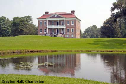
Drayton Hall, Charleston
Thomas Drayton’s son John purchased land adjoining Magnolia Plantation in 1738 to set up a rice plantation and he also began the construction of Drayton Hall. Apart from a period of occupation by British forces during the Revolutionary War, the plantation prospered right up to the Civil War when it was one of few Ashley River plantations to escape destruction. The Drayton family decided not to restart the rice plantation but instead focus on phosphate mining, which continued until the early 20th century. In the 20th century the hall was used only as a holiday home and little was done to modernise it. In 1974 Drayton Hall was sold to the National Trust for Historic Preservation who have preserved it and opened it to the public. Click Tab 2 to see a picture of the Ballroom.
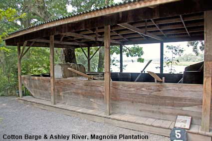
Cotton Barge & Ashley River, Magnolia Plantation, Charleston
Nowadays Magnolia Plantation is operated as a tourist attraction. Apart from the gardens and grounds, tours are available of the restored house, gardens, slave quarters and rice fields. The gardens lead to the banks of the Ashley River which was essential for transport in the plantation era. The river would have been busy with ships and barges carrying cotton and rice down to Charleston. The barge on show here would have been used to transport cotton from plantations further inland rather than the rice produced at Magnolia Plantation.
Plantations
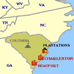
Click on Minimap to navigate
Home > US States > The South > South Carolina >




DLU101108



To move forwards or backwards through the South Carolina trail click the arrows above, or select your next destination on the Minimap.


© Mike Elsden 1981 - 2025
The contents of this page may not be reproduced in full or in part without permission

